With hurricane season underway, the Texas Commission on Environmental Quality is gathering resources to respond to disasters that may come Texas’ way. One of those resources relatively new to the agency is an Unmanned Aerial Systems program.
In early 2020, TCEQ’s Emergency Management Support Team began developing a new UAS program with the purchase of four unmanned aircraft systems, aka drones, to use during emergencies.

The UAS program provides aerial support to regional staff for emergency response activities and other types of field investigations, helping staff survey land difficult for humans to visit by foot or in a vehicle.
“The UAS provides a new platform for situational awareness during emergency responses that we have not had before or that we previously had to contract out,” said Anthony Buck, TCEQ’s Emergency Management Coordinator. “One of the advantages of having a UAS allows TCEQ to put eyes in the sky and put the UAS in a position where we’re not putting someone in danger.”
So far, 27 TCEQ staff have completed 32 hours of classroom instruction through the Texas A&M Engineering Extension Service UAS course for Public Safety officials, 17 of which recently passed the FAA UAS exam and are now licensed commercial UAS pilots.
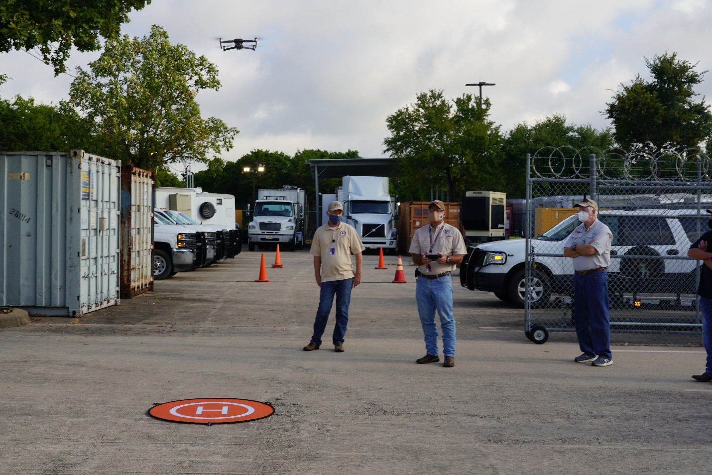
TCEQ now has 25 UAS or drones for the program equipped with DroneSense Software Platform to secure flight operations and allow for live streaming video during disaster events. Additional equipment allows the drones to perform other uses, such as optical gas imaging cameras or multi-gas monitors for air monitoring. Depending on the drone, they can be in flight between 20 to 45 minutes at a time. Each holds an SD card to capture data, such as longitude and latitude as well as photos that can be pieced together to show the Earth’s surface at a specific point in time so that it’s one seamless image rather than multiple photos. Inspectors could use the drones at the same site over time to see any changes to a facility or land.

Earlier this month, TCEQ’s 2021 Mickey Leland Environmental Internship Program interns were invited to TCEQ’s headquarters to learn more about the program.
The interns crowded around a tent where they learned about the UAS program from Emergency Management Liaison Abel Garcia before watching a test flight. GIS Analyst Catherine Hodde-Pierce also shared about how GIS analysts use photos taken from the drones to create a map using a geographic information system.
In the past, TCEQ contracted helicopter or UAS pilots to conduct aerial surveys. Now equipped with its own fleet, the agency can respond quicker and save on contractor costs.
EMST staff maintain a weekly UAS flight training schedule to develop and maintain their flight skills. Each of the pilots must have their license to fly and use a flight book to log their practice, which includes the date, time and other pertinent information.
This summer, EMST is rolling out the drone program to several TCEQ regional offices that have staff who have passed the FAA commercial license exam or will be taking the exam soon.
Having these resources on hand will give TCEQ an additional tool to respond following hurricanes in a hurry.